WunderBlog Archive » Category 6™
Category 6 has moved! See the latest from Dr. Jeff Masters and Bob Henson here.Wait-and-See Drama With 99L Will Continue For Up to Another Week
The week-long wait-and-see drama will continue for up to another week with the large but disorganized tropical wave (Invest 99L) chugging west-northwest at 10 mph through The Bahamas. Satellite loops late Friday afternoon showed an increase in the storm’s organization and heavy thunderstorms, but there was no well-organized surface circulation center and the amount of heavy thunderstorm activity was modest at best. Wind shear dropped from a high 20 - 25 knots early Friday morning to a moderate 10 - 15 mph by Friday afternoon, which allowed the increase in 99L’s heavy thunderstorms near its center to occur. However, 99L was still struggling with dry air, as seen on water vapor satellite imagery. Arc-shaped lines of surface cumulus clouds forming along the outflow boundaries of dry thunderstorm downdrafts, as seen in visible satellite imagery (Figure 1), were more evidence that the storm was struggling with dry air. Sea surface temperatures (SSTs) remained favorable for development, though: 29.5°C (85°F). Satellite-measured surface winds at 10:17 am EDT Friday from the ASCAT instrument were as high as 35 mph in the heaviest thunderstorms to the east of 99L’s center. The Hurricane Hunters did not investigate 99L on Friday, but are scheduled to investigate again on Saturday afternoon.

Figure 1. MODIS visible satellite image of 99L taken Friday morning, August 26, 2016. A surface circulation center was trying to form over the central Bahamas. Heavy thunderstorms were building along the southeast side of the center, but were ingesting dry mid-level air. This dry air causes evaporative cooling, creating cooler, dense air and strong downdrafts within 99L’s thunderstorms, robbing them of moisture. When these downdraft hit the ocean, they spread out horizontally, creating an arc-shaped band of surface cumulus clouds showing the outflow boundary of the air from the downdraft. As 99L continues to struggle with dry air, expect to see more of these arc-shaped outflow boundaries.

Figure 2. The vertical wind shear between 200 mb and 850 mb as analyzed by the University of Wisconsin/CIMSS on Friday morning, August 26, 2016. In the space of six hours, the wind shear near the core of 99L fell from about 25 - 30 knots (yellow-green to yellow colors), to about 15 knots (dark blue-green colors.) The dashed light blue lines show where there had been a 5 knot decrease in wind shear over the previous 24 hours; the white solid lines outline areas where the wind shear had increased by 5 knots in 24 hours. The reduction in wind shear on Friday helped allow 99L to grow more organized and build some heavy thunderstorms near its center.
Track forecast for 99L
A strong ridge of high pressure now covering much of the Southeast U.S. and northern Gulf of Mexico will remain in place through Sunday, which should keep 99L on its general west-northwest track at 5 - 10 mph for the next three days. The storm will reach South Florida and the Florida Keys on Sunday morning. At that point, the models diverge, with the GFS and European model predicting that the ridge of high pressure steering the storm will weaken, allowing 99L to turn more to the north. The UKMET model keeps 99L moving west-northwest into the central Gulf of Mexico, keeping the storm in the Gulf through next Friday.
Intensity forecast for 99L
Since 99L has moved into an area of higher moisture and lower wind shear, the storm is likely to slowly but steadily organize. The SHIPS model on Friday afternoon predicted that wind shear would remain mostly in the moderate range, 10 - 15 knots, for the next five days. SSTs will increase to 30°C (86°F) by Sunday, and mid-level relative humidity was predicted to increase from 65% to 70%. However, there will still be some dry air for 99L to contend with.
Two of our three reliable models for predicting tropical genesis, the ECMWF and GFS, did not show development of 99L into a tropical cyclone over the next five days in their latest 12Z Friday (8 am EDT) runs. These models brought 99L northwards along the west coast of Florida early next week, spreading heavy rains of 3 - 5” along the west coast of Florida. Our other reliable tropical cyclone genesis model, the UKMET, continued to predict that 99L would develop into a hurricane in the central Gulf of Mexico by the middle of next week. At this point, pretty much any outcome you can imagine is still on the table--failure to develop, development into a weak but rainy tropical storm, or intensification into a hurricane over the Gulf of Mexico. In their 2 pm EDT Friday Tropical Weather Outlook, NHC gave 99L 2-day and 5-day odds of development into a tropical depression or tropical storm of 30% and 60%, respectively.
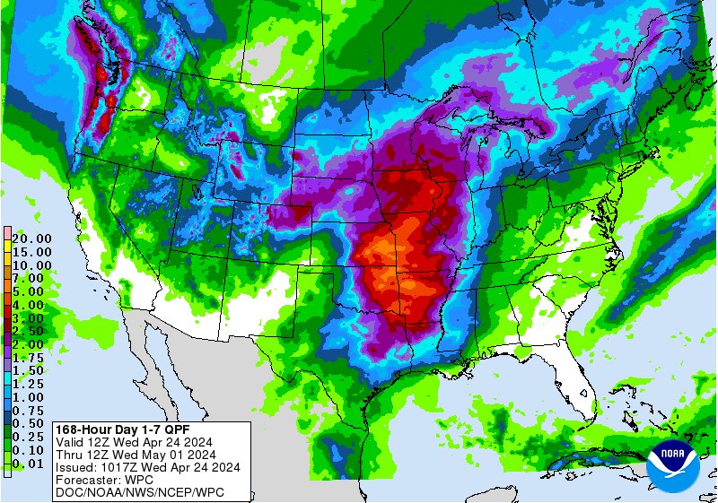
Regardless of whether or not 99L ever becomes Tropical Storm Hermine, Florida is going to get some rain from this system. The 7-day precipitation outlook from NOAA’s Weather Prediction Center (WPC) calls for a large area of 3 - 5” rains across southern and western Florida over the coming week. If 99L takes the more westerly track predicted by the UKMET model, west Florida will be spared the heaviest rains.
I’ll continue to plug away documenting the life and times of 99L and its seemingly eternal quest to get its name on Saturday.
Jeff Masters
Figure 1. MODIS visible satellite image of 99L taken Friday morning, August 26, 2016. A surface circulation center was trying to form over the central Bahamas. Heavy thunderstorms were building along the southeast side of the center, but were ingesting dry mid-level air. This dry air causes evaporative cooling, creating cooler, dense air and strong downdrafts within 99L’s thunderstorms, robbing them of moisture. When these downdraft hit the ocean, they spread out horizontally, creating an arc-shaped band of surface cumulus clouds showing the outflow boundary of the air from the downdraft. As 99L continues to struggle with dry air, expect to see more of these arc-shaped outflow boundaries.
Figure 2. The vertical wind shear between 200 mb and 850 mb as analyzed by the University of Wisconsin/CIMSS on Friday morning, August 26, 2016. In the space of six hours, the wind shear near the core of 99L fell from about 25 - 30 knots (yellow-green to yellow colors), to about 15 knots (dark blue-green colors.) The dashed light blue lines show where there had been a 5 knot decrease in wind shear over the previous 24 hours; the white solid lines outline areas where the wind shear had increased by 5 knots in 24 hours. The reduction in wind shear on Friday helped allow 99L to grow more organized and build some heavy thunderstorms near its center.
Track forecast for 99L
A strong ridge of high pressure now covering much of the Southeast U.S. and northern Gulf of Mexico will remain in place through Sunday, which should keep 99L on its general west-northwest track at 5 - 10 mph for the next three days. The storm will reach South Florida and the Florida Keys on Sunday morning. At that point, the models diverge, with the GFS and European model predicting that the ridge of high pressure steering the storm will weaken, allowing 99L to turn more to the north. The UKMET model keeps 99L moving west-northwest into the central Gulf of Mexico, keeping the storm in the Gulf through next Friday.
Intensity forecast for 99L
Since 99L has moved into an area of higher moisture and lower wind shear, the storm is likely to slowly but steadily organize. The SHIPS model on Friday afternoon predicted that wind shear would remain mostly in the moderate range, 10 - 15 knots, for the next five days. SSTs will increase to 30°C (86°F) by Sunday, and mid-level relative humidity was predicted to increase from 65% to 70%. However, there will still be some dry air for 99L to contend with.
Two of our three reliable models for predicting tropical genesis, the ECMWF and GFS, did not show development of 99L into a tropical cyclone over the next five days in their latest 12Z Friday (8 am EDT) runs. These models brought 99L northwards along the west coast of Florida early next week, spreading heavy rains of 3 - 5” along the west coast of Florida. Our other reliable tropical cyclone genesis model, the UKMET, continued to predict that 99L would develop into a hurricane in the central Gulf of Mexico by the middle of next week. At this point, pretty much any outcome you can imagine is still on the table--failure to develop, development into a weak but rainy tropical storm, or intensification into a hurricane over the Gulf of Mexico. In their 2 pm EDT Friday Tropical Weather Outlook, NHC gave 99L 2-day and 5-day odds of development into a tropical depression or tropical storm of 30% and 60%, respectively.
Regardless of whether or not 99L ever becomes Tropical Storm Hermine, Florida is going to get some rain from this system. The 7-day precipitation outlook from NOAA’s Weather Prediction Center (WPC) calls for a large area of 3 - 5” rains across southern and western Florida over the coming week. If 99L takes the more westerly track predicted by the UKMET model, west Florida will be spared the heaviest rains.
I’ll continue to plug away documenting the life and times of 99L and its seemingly eternal quest to get its name on Saturday.
Jeff Masters
The views of the author are his/her own and do not necessarily represent the position of The Weather Company or its parent, IBM.