WunderBlog Archive » Category 6™
Category 6 has moved! See the latest from Dr. Jeff Masters and Bob Henson here.Three Non-Threatening Atlantic Invests to Watch: 92L, 93L, and 94L
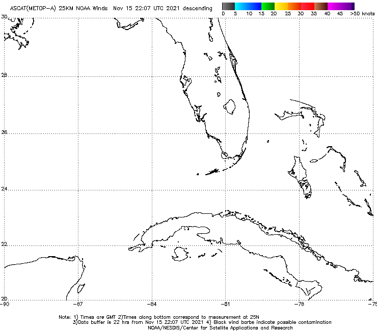
An area of low pressure with a well-defined surface circulation developed on Friday afternoon in the Florida Straits, just east of the Florida Keys. This disturbance had been designated as Invest 92L earlier in the week, but then dropped, once the system lost nearly all of its heavy thunderstorms. Now, NHC is once more calling this system 92L. Satellite images and long range radar out of Key West show that 92L has well-defined surface circulation center, but almost no heavy thunderstorms. The storm’s heaviest thunderstorms were being kept to the southeast side of the center of circulation by high wind shear of 20 - 25 knots from strong upper-level winds out of the northwest. The disturbance was also battling plenty of dry air, as seen on water vapor satellite loops, and the 8 am EDT Friday run of the SHIPS model showed the humidity at mid-levels of the atmosphere was about 55 - 60%, which is marginal for tropical storm formation. Sea surface temperatures (SSTs) were a very warm 30°C (86°F), though. Surface winds measured by the ASCAT satellite instrument were as high as 35 mph at 10:28 am EDT Friday.

Figure 1. MODIS visible satellite image of 92L taken early Friday afternoon, September 9, 2016. Image credit: NASA.
Forecast for 92L
There is little model support for the development of 92L, with none of the 00Z Friday operational versions of our three reliable models for predicting tropical cyclone genesis--the GFS, UKMET and European models--predicting development. Only 4% of the 50 ensemble members of the European model predicted development, and none of the 20 members of the GFS model ensemble did so. During the next five days, 92L should experience dry mid-level air with a relative humidity of 60 - 65%, and see moderately high wind shear of 15 - 25 knots, as the storm heads west at about 5 mph through the southern Gulf of Mexico, according to the 8 am EDT Friday run of the SHIPS model. These conditions are quite marginal for development. In their 2 pm EDT Friday Tropical Weather Outlook, NHC gave this system 2-day and 5-day development odds of 40%. 92L will likely bring winds gusts near 40 mph and rain squalls to the Florida Keys Friday evening through Saturday afternoon.
Tropical wave 93L just northeast of Puerto Rico little threat to develop
An area of low pressure located 100 - 200 miles northeast of Puerto Rico on Friday afternoon was headed west-northwest at about 15 mph. This system was designated Invest 93L by NHC on Thursday morning. Satellite images and long range radar out of Puerto Rico show that 93L has only a limited amount of heavy thunderstorms, with no sign of a surface circulation center. The disturbance was battling plenty of dry air, as seen on water vapor satellite loops, and the 8 am EDT Friday run of the SHIPS model showed the humidity at mid-levels of the atmosphere was about 45 - 50%, which is normally too dry to support tropical storm formation unless wind shear is very low. Wind shear was a moderate 10 - 20 knots over 93L, and sea surface temperatures (SSTs) were a warm 29°C (84°F.)

Figure 2. Latest satellite image of 93L.
Forecast for 93L
There is very little model support for the development of 93L, with none of the 00Z Friday operational versions of our three reliable models for predicting tropical cyclone genesis--the GFS, UKMET and European models--predicting development. Only 8% of the 50 ensemble members of the European model predicted development, and none of the 20 members of the GFS model ensemble did so. The 8 am EDT Friday run of the SHIPS model predicted that 93L would find a moister surrounding atmosphere by Sunday, but that wind shear would grow high, greater than 20 knots, by then. These conditions are quite marginal for development. In their 2 pm EDT Friday Tropical Weather Outlook, NHC gave this system 2-day and 5-day development odds of 10% and 10%, respectively. Invest 93L will continue moving west-northwest to northwest at about 15 mph over the next two days, then slow down to a forward speed of about 10 mph on Monday and Tuesday. This should put the storm a few hundred miles southeast of the coast of South Carolina by Tuesday.

Figure 2. Latest satellite image of 94L.
Tropical wave 94L in the central tropical Atlantic likely to develop
A large tropical wave midway between the coast of Africa and the Lesser Antilles Islands (Invest 94L) was headed west-northwest at 20 mph Friday afternoon. Satellite images showed that 94L was becoming well-organized, with a large circulation and an increasing amount of heavy thunderstorms. With wind shear expected to be in the low to moderate range through Tuesday, along with plenty of warm water and a moist atmosphere with 70% humidity at middle levels of the atmosphere, 94L is likely to develop into a tropical depression by early next week, as predicted our top three models for hurricane genesis, the UKMET, GFS and European models. In their 2 pm EDT Friday Tropical Weather Outlook, NHC gave this system 2-day and 5-day development odds of 50% and 80%, respectively. The long-range models are showing 94L will likely be a “fish storm”, and take a west-northwesterly then northwesterly track into the Central Atlantic to a location where few storms ever become a threat to the Lesser Antilles Islands or North America. The next name on the Atlantic list of storms is Ian.

Figure 4. NASA-NOAA's Suomi NPP satellite captured this image of Hurricane Gaston (Category 2, 105 mph winds) in the central North Atlantic on August 30, 2016, at 1625Z (12:25 p.m. EDT). Gaston was the only major hurricane of the first half of the 2016 Atlantic hurricane season, peaking as a Category 3 storm with 120 mph winds on August 29. Image credit: NOAA / NASA Goddard MODIS Rapid Response Team.
Midpoint review: A fairly active, not-too-destructive Atlantic season
Now that we’re at the climatological midpoint of the Atlantic hurricane season (September 10 or 11, depending upon which statistics one uses), it’s a good time to review how this season is shaping up. We can compare this season to what one might expect from climatology based on data compiled by Phil Klotzbach (Colorado State University). As a climatological benchmark, Klotzbach uses the 30-year period from 1981 to 2010, which is almost evenly split between the pre-1995 inactive period and the post-1995 active period in the Atlantic. Here’s where we stand as of September 9 relative to the amount of activity that an average season would have produced by now:
8 named storms (typical by 9/9 is 6.5)
4 hurricanes (typical by 9/9 is 2.7)
1 major hurricane (typical by 9/9 is 1.2)
40.7 ACE, or accumulated cyclone energy (typical by 9/9 is 46.2)
This season is running a bit below average on ACE, as well as the number of hurricane days and major-hurricane days (not shown here). We are considerably above average on the number of named storms and hurricanes. If we continued the rest of the season at exactly this pace, we'd end up with 16 named storms, 8 hurricanes, and 2 majors. That would line up pretty well with the consensus of the various forecast groups as summarized by Phil Klotzbach. Here again, we're running ahead of the consensus on the number of named storms and hurricanes, but a bit under expectation on the amount of ACE. The four tropical storms this year were all quite weak (Bonnie, Colin, Danielle, Fiona). About 60% of the entire season’s ACE thus far--more than every other tropical cyclone combined--was generated by long-lived Hurricane Gaston, which stayed far out to sea. The most destructive Atlantic system of the year thus far, Hurricane Hermine, produced total economic damages that could approach $1 billion. We’ve had one quite deadly storm this year: Hurricane Earl, which hit Belize as a Category 1 storm on August 4, then made a second landfall on Mexico’s Bay of Campeche coast on August 6. Earl killed 67 people and left 12 others missing; 57 of the fatalities were in Mexico, due to flooding and mudslides.
NOAA: La Niña a no-show
On Thursday, NOAA cancelled its La Niña Watch, as the atmosphere has failed to respond to sea-surface temperatures in the borderline La Niña range. If La Niña indeed fails to materialize, then the rest of the Atlantic season may end up less active than predicted by some of the higher-end outlooks that anticipated La Niña’s emergence.
We'll have an update on Saturday afternoon.
Jeff Masters and Bob Henson
Figure 1. MODIS visible satellite image of 92L taken early Friday afternoon, September 9, 2016. Image credit: NASA.
Forecast for 92L
There is little model support for the development of 92L, with none of the 00Z Friday operational versions of our three reliable models for predicting tropical cyclone genesis--the GFS, UKMET and European models--predicting development. Only 4% of the 50 ensemble members of the European model predicted development, and none of the 20 members of the GFS model ensemble did so. During the next five days, 92L should experience dry mid-level air with a relative humidity of 60 - 65%, and see moderately high wind shear of 15 - 25 knots, as the storm heads west at about 5 mph through the southern Gulf of Mexico, according to the 8 am EDT Friday run of the SHIPS model. These conditions are quite marginal for development. In their 2 pm EDT Friday Tropical Weather Outlook, NHC gave this system 2-day and 5-day development odds of 40%. 92L will likely bring winds gusts near 40 mph and rain squalls to the Florida Keys Friday evening through Saturday afternoon.
Tropical wave 93L just northeast of Puerto Rico little threat to develop
An area of low pressure located 100 - 200 miles northeast of Puerto Rico on Friday afternoon was headed west-northwest at about 15 mph. This system was designated Invest 93L by NHC on Thursday morning. Satellite images and long range radar out of Puerto Rico show that 93L has only a limited amount of heavy thunderstorms, with no sign of a surface circulation center. The disturbance was battling plenty of dry air, as seen on water vapor satellite loops, and the 8 am EDT Friday run of the SHIPS model showed the humidity at mid-levels of the atmosphere was about 45 - 50%, which is normally too dry to support tropical storm formation unless wind shear is very low. Wind shear was a moderate 10 - 20 knots over 93L, and sea surface temperatures (SSTs) were a warm 29°C (84°F.)
Figure 2. Latest satellite image of 93L.
Forecast for 93L
There is very little model support for the development of 93L, with none of the 00Z Friday operational versions of our three reliable models for predicting tropical cyclone genesis--the GFS, UKMET and European models--predicting development. Only 8% of the 50 ensemble members of the European model predicted development, and none of the 20 members of the GFS model ensemble did so. The 8 am EDT Friday run of the SHIPS model predicted that 93L would find a moister surrounding atmosphere by Sunday, but that wind shear would grow high, greater than 20 knots, by then. These conditions are quite marginal for development. In their 2 pm EDT Friday Tropical Weather Outlook, NHC gave this system 2-day and 5-day development odds of 10% and 10%, respectively. Invest 93L will continue moving west-northwest to northwest at about 15 mph over the next two days, then slow down to a forward speed of about 10 mph on Monday and Tuesday. This should put the storm a few hundred miles southeast of the coast of South Carolina by Tuesday.
Figure 2. Latest satellite image of 94L.
Tropical wave 94L in the central tropical Atlantic likely to develop
A large tropical wave midway between the coast of Africa and the Lesser Antilles Islands (Invest 94L) was headed west-northwest at 20 mph Friday afternoon. Satellite images showed that 94L was becoming well-organized, with a large circulation and an increasing amount of heavy thunderstorms. With wind shear expected to be in the low to moderate range through Tuesday, along with plenty of warm water and a moist atmosphere with 70% humidity at middle levels of the atmosphere, 94L is likely to develop into a tropical depression by early next week, as predicted our top three models for hurricane genesis, the UKMET, GFS and European models. In their 2 pm EDT Friday Tropical Weather Outlook, NHC gave this system 2-day and 5-day development odds of 50% and 80%, respectively. The long-range models are showing 94L will likely be a “fish storm”, and take a west-northwesterly then northwesterly track into the Central Atlantic to a location where few storms ever become a threat to the Lesser Antilles Islands or North America. The next name on the Atlantic list of storms is Ian.
Figure 4. NASA-NOAA's Suomi NPP satellite captured this image of Hurricane Gaston (Category 2, 105 mph winds) in the central North Atlantic on August 30, 2016, at 1625Z (12:25 p.m. EDT). Gaston was the only major hurricane of the first half of the 2016 Atlantic hurricane season, peaking as a Category 3 storm with 120 mph winds on August 29. Image credit: NOAA / NASA Goddard MODIS Rapid Response Team.
Midpoint review: A fairly active, not-too-destructive Atlantic season
Now that we’re at the climatological midpoint of the Atlantic hurricane season (September 10 or 11, depending upon which statistics one uses), it’s a good time to review how this season is shaping up. We can compare this season to what one might expect from climatology based on data compiled by Phil Klotzbach (Colorado State University). As a climatological benchmark, Klotzbach uses the 30-year period from 1981 to 2010, which is almost evenly split between the pre-1995 inactive period and the post-1995 active period in the Atlantic. Here’s where we stand as of September 9 relative to the amount of activity that an average season would have produced by now:
8 named storms (typical by 9/9 is 6.5)
4 hurricanes (typical by 9/9 is 2.7)
1 major hurricane (typical by 9/9 is 1.2)
40.7 ACE, or accumulated cyclone energy (typical by 9/9 is 46.2)
This season is running a bit below average on ACE, as well as the number of hurricane days and major-hurricane days (not shown here). We are considerably above average on the number of named storms and hurricanes. If we continued the rest of the season at exactly this pace, we'd end up with 16 named storms, 8 hurricanes, and 2 majors. That would line up pretty well with the consensus of the various forecast groups as summarized by Phil Klotzbach. Here again, we're running ahead of the consensus on the number of named storms and hurricanes, but a bit under expectation on the amount of ACE. The four tropical storms this year were all quite weak (Bonnie, Colin, Danielle, Fiona). About 60% of the entire season’s ACE thus far--more than every other tropical cyclone combined--was generated by long-lived Hurricane Gaston, which stayed far out to sea. The most destructive Atlantic system of the year thus far, Hurricane Hermine, produced total economic damages that could approach $1 billion. We’ve had one quite deadly storm this year: Hurricane Earl, which hit Belize as a Category 1 storm on August 4, then made a second landfall on Mexico’s Bay of Campeche coast on August 6. Earl killed 67 people and left 12 others missing; 57 of the fatalities were in Mexico, due to flooding and mudslides.
NOAA: La Niña a no-show
On Thursday, NOAA cancelled its La Niña Watch, as the atmosphere has failed to respond to sea-surface temperatures in the borderline La Niña range. If La Niña indeed fails to materialize, then the rest of the Atlantic season may end up less active than predicted by some of the higher-end outlooks that anticipated La Niña’s emergence.
We'll have an update on Saturday afternoon.
Jeff Masters and Bob Henson
The views of the author are his/her own and do not necessarily represent the position of The Weather Company or its parent, IBM.