WunderBlog Archive » Category 6™
Category 6 has moved! See the latest from Dr. Jeff Masters and Bob Henson here.Powerful Atmospheric River Set to Blast the U.S. West Coast
From San Francisco to Seattle, millions are watching and waiting for the arrival of 2015’s first major atmospheric river event. The impending AR will likely be the most intensely observed in weather history, thanks to an armada of instruments deployed across California and the Northeast Pacific for the CalWater 2015 study. (See my Tuesday post for more details.) The AR will plow into the coast Thursday night and Friday, with its core gradually sagging southward into central California by Friday afternoon into Saturday morning. Assuming the rain holds off through midnight Thursday night, downtown San Francisco will have just edged out November-December 1976 for the city’s second-longest midwinter dry spell on record (43 dry days). The only longer dry period is 60 days, from November 17, 1876 through January 15, 1877.
Multiple periods of heavy rain are on tap for much of northern California, western Oregon, and western Washington, with rainfall rates exceeding 1”/hour and a few thunderstorms possible in California. The most intense rain and snow can be expected along the west slopes of mountain ranges, as extremely strong low- to mid-level winds packed with tropical moisture strike the mountains. Water vapor at the core of the AR is at more than 200% of average seasonal values. Wind gusts may exceed 60 mph near the coast and at high altitudes. Even stronger gusts above 100 mph are possible along the crest of the Sierra; high wind warnings have also been posted for the range’s eastern slope, where mountain-wave features could produce gusts of 60 - 80 mph.

Figure 1. There’s no missing the powerful atmospheric river on this map of projected flow at 700 hPa (700 mb) at 1500 GMT on Friday, February 6. Image credit: earth.nullschool.net.
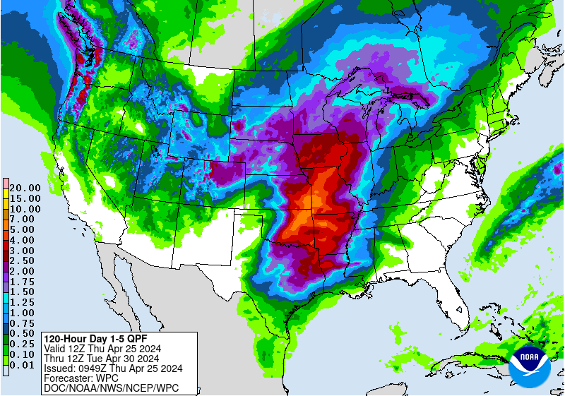
Forecasters still expect a large area of 5 - 10” of rain over the next several days (see Figure 2 below), and today’s models suggest that heavy rains may extend southward from the San Francisco Bay area. West-facing slopes of the central and northern Sierra should also get several inches of beneficial rain, with as much as 3 feet of dense “Sierra cement” snow at the highest elevations. Snow levels in the Sierra will remain very high for a midwinter storm (generally above 8000 feet) until somewhat colder air arrives with the concluding system on Sunday and Monday, when elevations down to Lake Tahoe could see several inches of snow. Illustrating the warmth ahead of this system, Reno set a daily record high of 70°F on Thursday; only three other times has the city has reached 70°F so early in the calendar year.
Overall, the rains from this event should help replenish reservoirs in central California and provide welcome greening of vegetation across a large area. The critical Sierra snowpack (which provides about a third of California water supply) may only see modest improvement from its very low levels for this time of year. Little rain from this system will fall on Southern California, where the multiyear drought has had its firmest grip.
Widespread, severe river flooding is not expected with this system, but flood watches are in effect for most of coastal northern California and southern Oregon, as well as western Washington, where the Skokomish River is already near flood stage. Some localized flooding can be expected with the most intense downpours on Friday into Saturday; that risk may rise as soils saturate and rivers fill up (see Figure 3 below). Rains should be on the decrease later in the weekend before a final blast arrives with a colder, more well-defined upper-level storm on Sunday and Monday.
Bob Henson

Figure 2. Projected five-day precipitation totals from 0000 GMT Friday, February 6, to 0000 GMT Wednesday, February 11. Image credit: NOAA/NCEP/Weather Prediction Center.

Figure 3. From drought to deluge: the Russian River at Guerneville, California, is projected to swell from its current level of 5 feet to a peak of 26.3 feet by next Monday, February 9. Image credit: NWS Advanced Hydrologic Prediction Service.
Multiple periods of heavy rain are on tap for much of northern California, western Oregon, and western Washington, with rainfall rates exceeding 1”/hour and a few thunderstorms possible in California. The most intense rain and snow can be expected along the west slopes of mountain ranges, as extremely strong low- to mid-level winds packed with tropical moisture strike the mountains. Water vapor at the core of the AR is at more than 200% of average seasonal values. Wind gusts may exceed 60 mph near the coast and at high altitudes. Even stronger gusts above 100 mph are possible along the crest of the Sierra; high wind warnings have also been posted for the range’s eastern slope, where mountain-wave features could produce gusts of 60 - 80 mph.
Figure 1. There’s no missing the powerful atmospheric river on this map of projected flow at 700 hPa (700 mb) at 1500 GMT on Friday, February 6. Image credit: earth.nullschool.net.
Forecasters still expect a large area of 5 - 10” of rain over the next several days (see Figure 2 below), and today’s models suggest that heavy rains may extend southward from the San Francisco Bay area. West-facing slopes of the central and northern Sierra should also get several inches of beneficial rain, with as much as 3 feet of dense “Sierra cement” snow at the highest elevations. Snow levels in the Sierra will remain very high for a midwinter storm (generally above 8000 feet) until somewhat colder air arrives with the concluding system on Sunday and Monday, when elevations down to Lake Tahoe could see several inches of snow. Illustrating the warmth ahead of this system, Reno set a daily record high of 70°F on Thursday; only three other times has the city has reached 70°F so early in the calendar year.
Overall, the rains from this event should help replenish reservoirs in central California and provide welcome greening of vegetation across a large area. The critical Sierra snowpack (which provides about a third of California water supply) may only see modest improvement from its very low levels for this time of year. Little rain from this system will fall on Southern California, where the multiyear drought has had its firmest grip.
Widespread, severe river flooding is not expected with this system, but flood watches are in effect for most of coastal northern California and southern Oregon, as well as western Washington, where the Skokomish River is already near flood stage. Some localized flooding can be expected with the most intense downpours on Friday into Saturday; that risk may rise as soils saturate and rivers fill up (see Figure 3 below). Rains should be on the decrease later in the weekend before a final blast arrives with a colder, more well-defined upper-level storm on Sunday and Monday.
Bob Henson
Figure 2. Projected five-day precipitation totals from 0000 GMT Friday, February 6, to 0000 GMT Wednesday, February 11. Image credit: NOAA/NCEP/Weather Prediction Center.
Figure 3. From drought to deluge: the Russian River at Guerneville, California, is projected to swell from its current level of 5 feet to a peak of 26.3 feet by next Monday, February 9. Image credit: NWS Advanced Hydrologic Prediction Service.
The views of the author are his/her own and do not necessarily represent the position of The Weather Company or its parent, IBM.